GIS News Feature
Mullet Season 2017
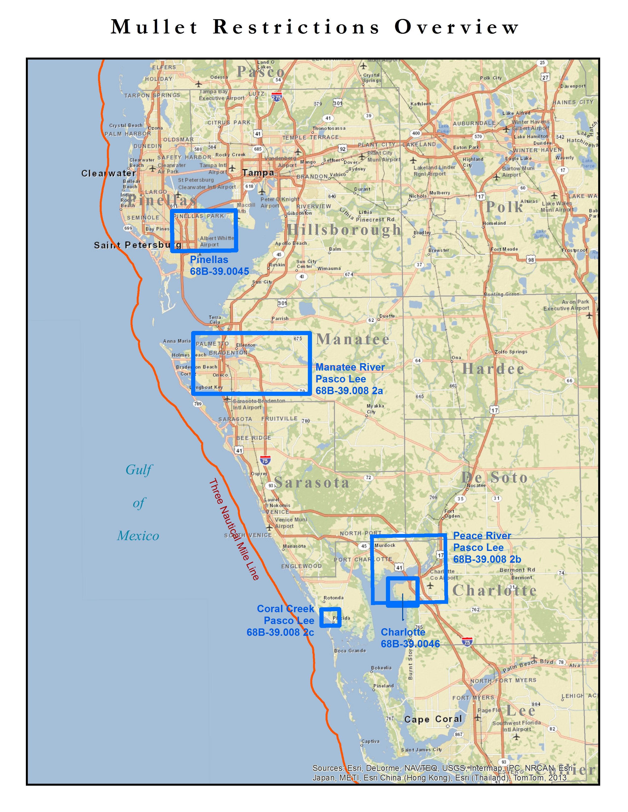
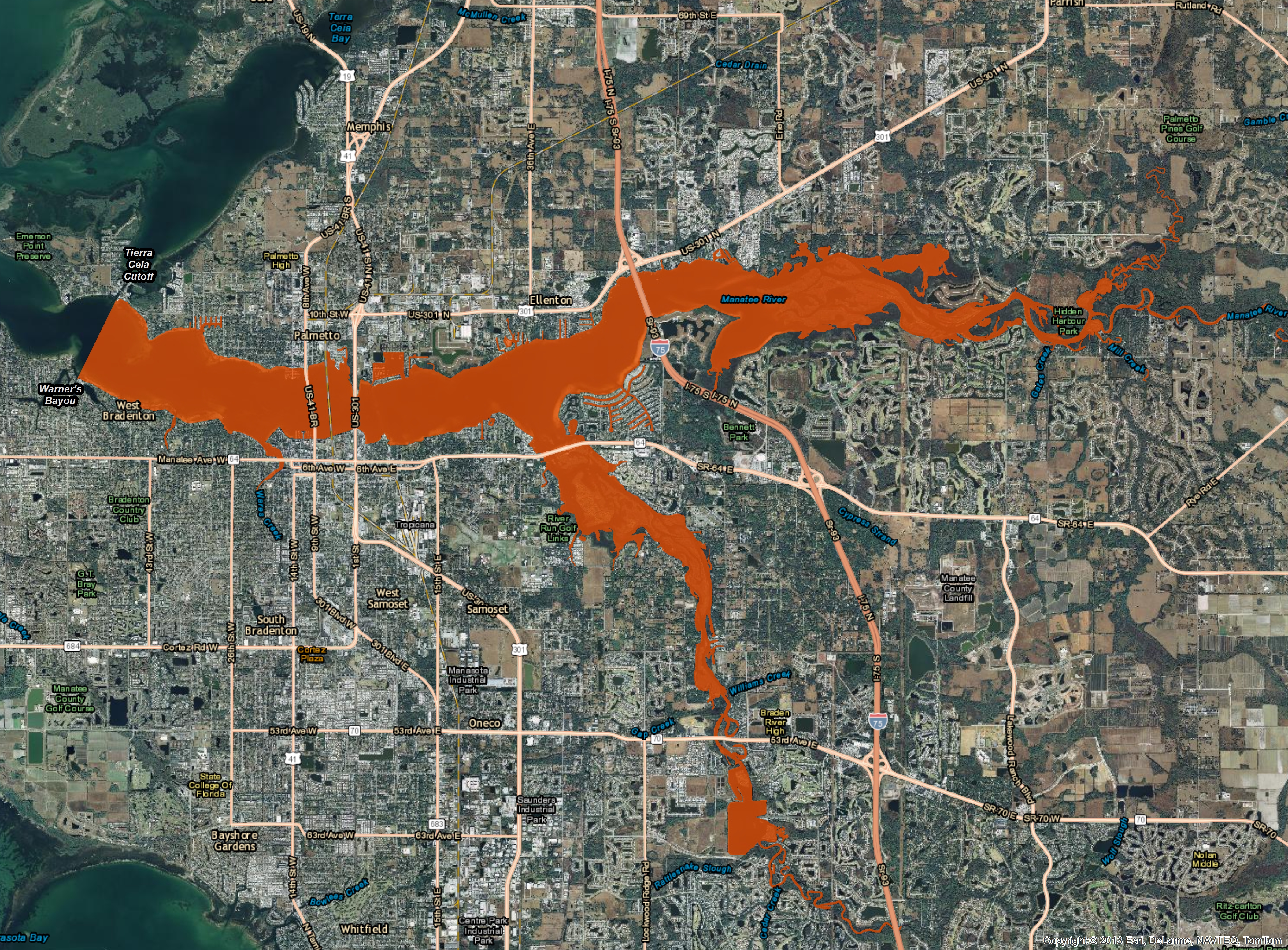
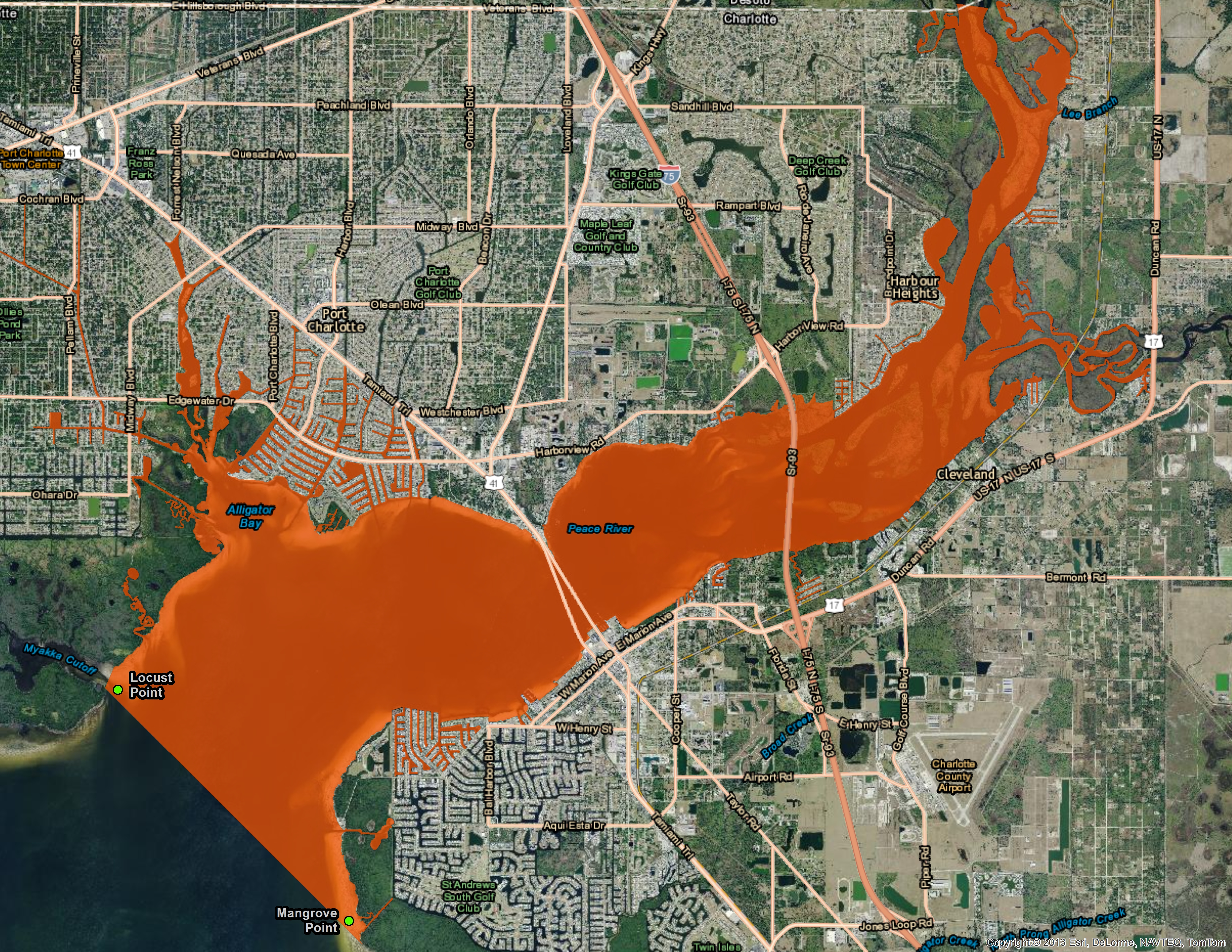
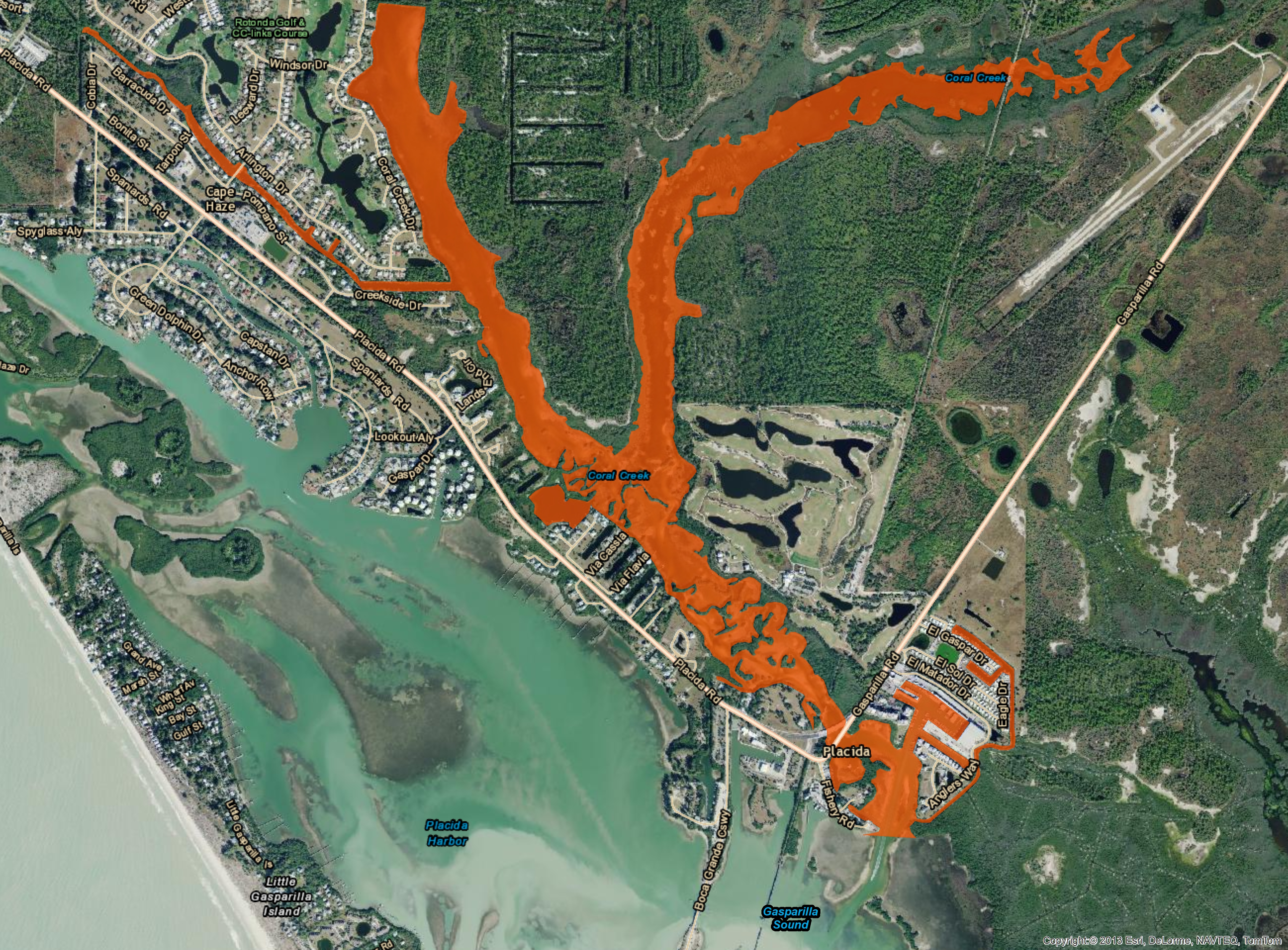
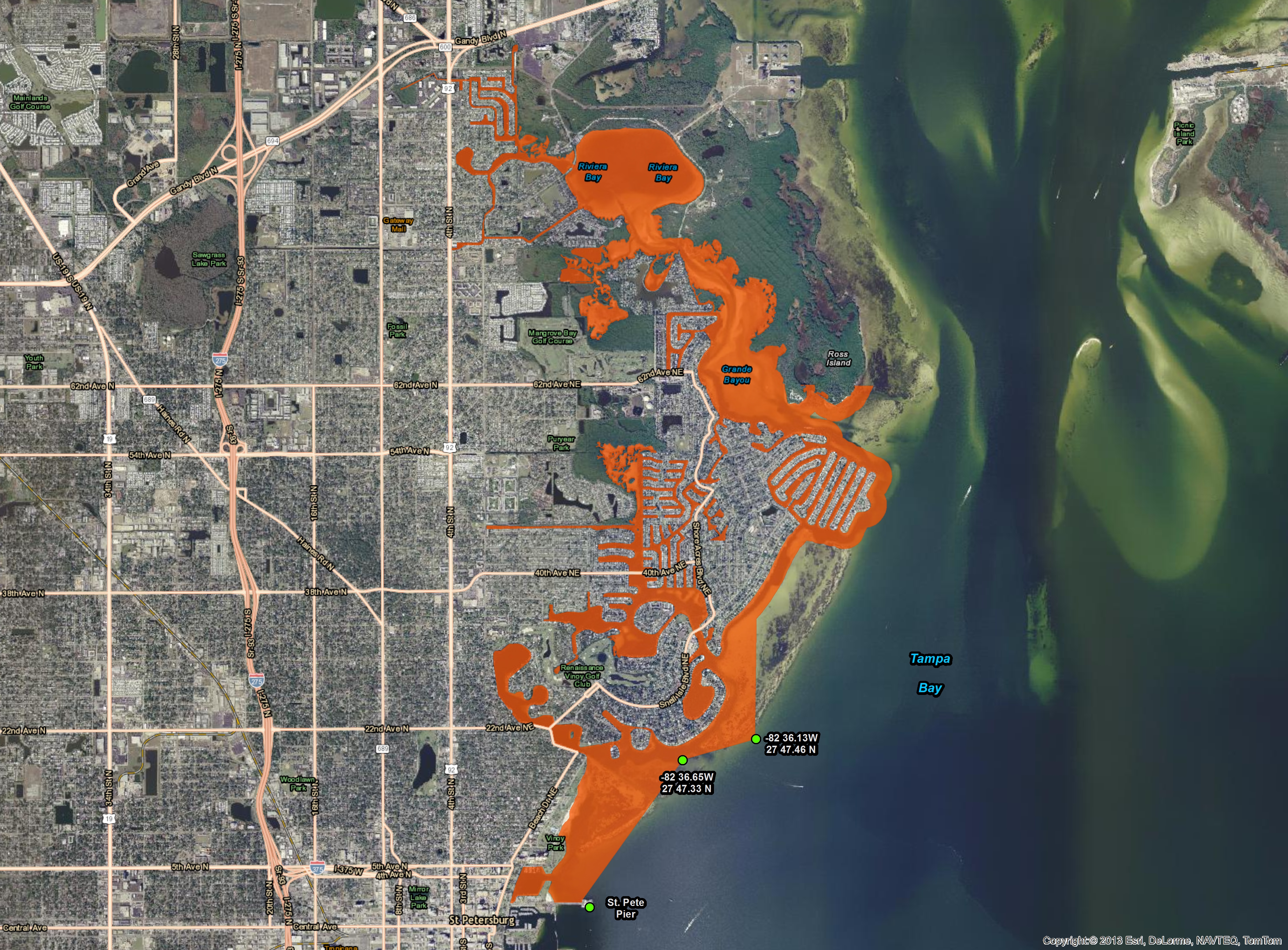
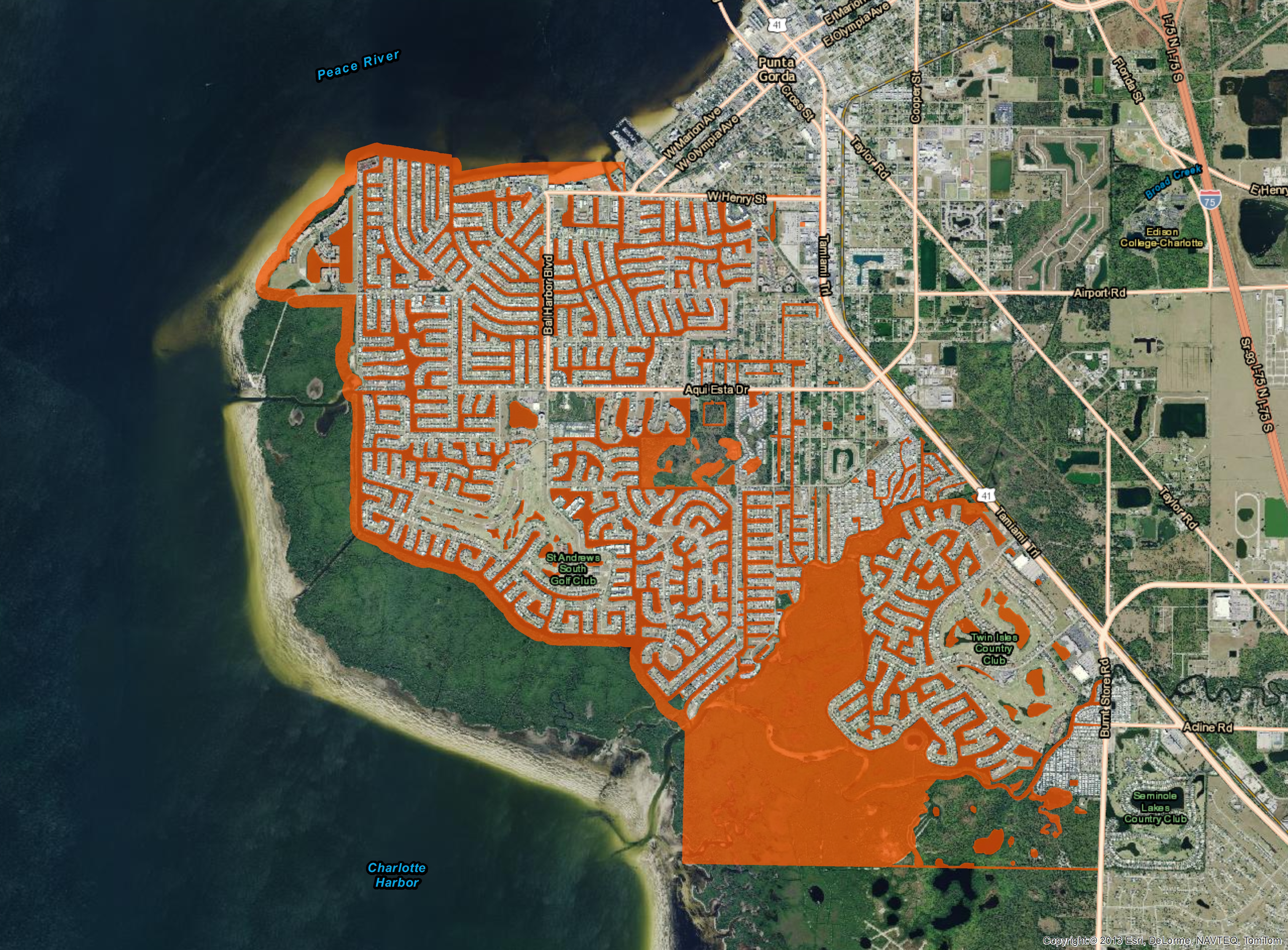
The below map documents show the Seasonal Mullet Closure as per statute 68B-39.
To read the adminstrative code 68B-39
CLICK HERE
Interactive Mapping Sites
CAUTION: The interactive mapping sites may take up to 20+ seconds to initially load the complex datasets
- Alligator Hunting Permits for 2021 Season
The site contains Alligator Hunting Permits residency for the 2021 Season along with the assigned Alligator Management Units - Gopher Sightings
The site contains Gopher Sightings for the past year and allows the capturing of Gopher Info for Violation, Needs to be Re-checked and Legal location. - Vessels at Risk
The site contains Vessles that have recieved citations related to Vessels at Risk Statute 327.4107 - Taxidermist & Meat Processing Facitlies
The site contains Taxidermist and Meat Processing facilties for the use in site visit documentaition. - Hunting Related Activity
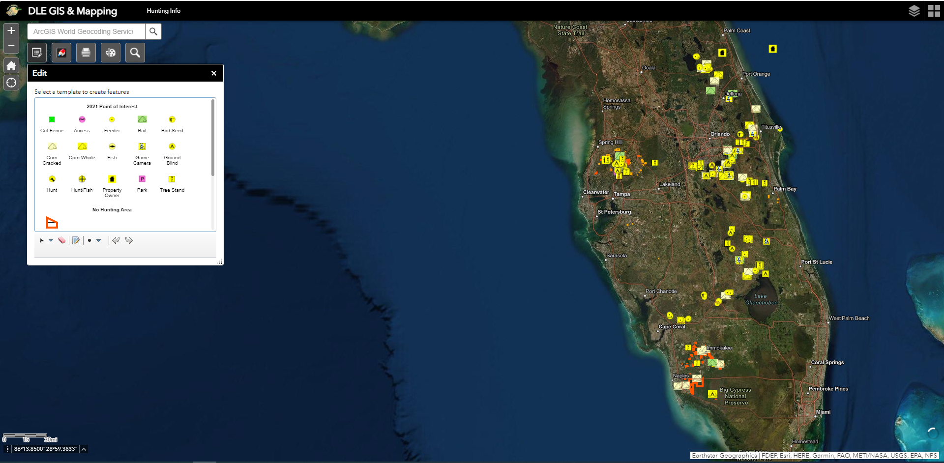
The site contains Hunting Information for the use in field operations detail. Collection of hunting related features i.e. bait locations, access points, tree stands, game cameras..... - Asset Tracker
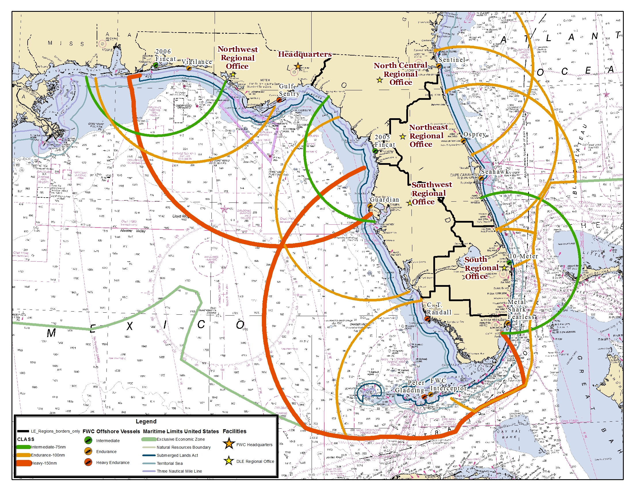
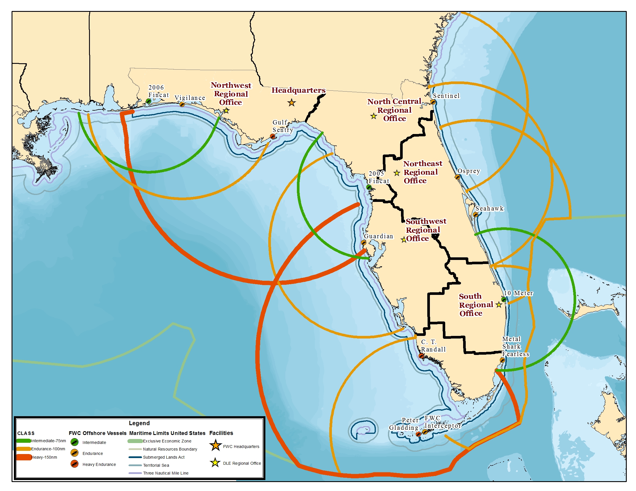
The site contains the locaction and status of vessels and speciality vehicles. - Port Inspectors
The site features shipping and port related data to help in inspection duties.
![]()
Hard Copy Maps
(click on the folders to expand)
- Letter Sized
- Academy Training
- Gasparilla Parade Route
- Boating Restricted Areas
- Boating Accidents
- Maintenance - Markers
- Manatee Zone Areas
- Marine Protected Areas
- Mullet Closure
- Seasonal Flip Signs
- State and Regional Information
FWC DLE Data
- Google Earth KML/KMZ Files
- GPS: Waypoints & Tracks
- Waterway Markers
Having an issue with the site, please e-mail FWC LE GIS Specialist jacob.tustison@MyFWC.com with any issues.